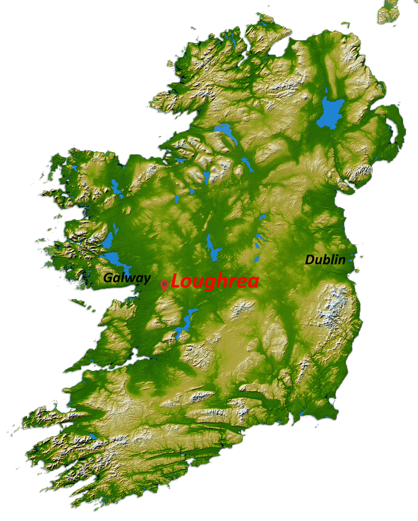


Loughrea Lake
Lough Rea
Co. Galway,
Ireland
Loughrea Lake, County Galway
- About 2.5km long (south-east to north-west) and 1.5km wide (south west to north east)
- Area of about 300 hectares
- Deepest point about 23m and average depth about 3.9m
The lake is underlain by carboniferous limestone and was formed probably by erosion during the last Ice Age which ended about 10,000 BC. During this Ice Age sheets of up to 3km thick moved across the country, scouring and pulverisng the landscape and making the features we are familiar with today. Due to the limestone the water is alkaline (hard water) and is of a very high quality, as evidenced by the Blue Flag beach at the Long Point. The Lake is fed by springs and small streams on the south-eastern shore.
The lake is internationally renowned for the presence of Crannoges – Reed’s Island, Shore Island, Ash Island and Island McCoo, and possibly Blake’s Island.
Some interesting extracts from:
“The Lake Dwellings of Ireland: or Ancient Lacustrine Habitations of Erin, commonly called Crannogs”
by W. A. WOOD-MARTIN, M.R.I.A., F.R.H.A.A.L,
LIEUT.-COLONEL 81ST BRIGADE NORTH IRISH DIVISION, R.A. ;
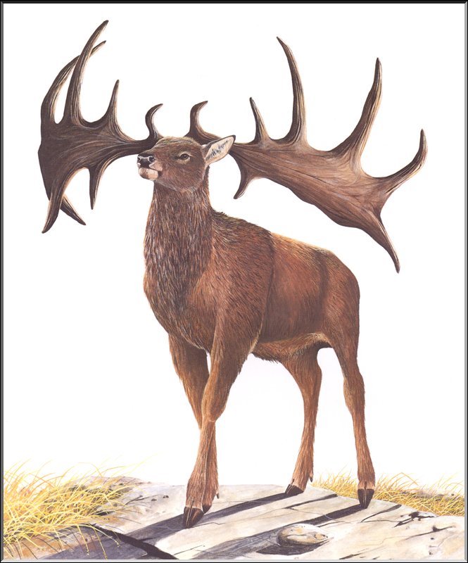
 Irish Bighorn
The fact of the co-existence of the Megaceros with man does not, however, rest on mere legend; for in a locality called the ” Elk Hole,” Co. Wexford, numerous skeletons of the extinct deer have been found in company with the remains of man, also a skull and horns, in the ” kitchen midden ” of the largest of the lake dwellings in Loughrea, Co. Galway, measuring over 13 feet from tip to tip of the antlers.
Getting rid of refuse
…by merely throwing it out of the door, a practice followed, on terra finna, by many of their descendants in Ireland at the present day. The accumulated mass of bones (invariably found in a broken state for extraction of the marrow) is in some instances immense ; it is estimated that at Dunshaughlin, in Meath, about two hundred tons were sold for manure, three hundred tons were exhumed from the kitchen midden of one of the lake dwellings in Loughrea, county Galway, and fifty tons from that of Ardakillen, county Roscommon ; the bones in the heaps have, evidently, in some instances, been gnawed by dogs after their owners had extracted the marrow, for which dainty the Irish appear to have had a peculiar relish, judging from their proverb, Má bhris tú an cnámh char dhuighail tú an smior, i. e., though you have broken the bone, you have not sucked out the marrow : equivalent to saying, ” you have done the most difficult part of the work, though you have not completed it.”
City Under the Lake
Loughrea is situated in the barony of same name. In the locality there lingered a tradition that a city lay buried under this lake, and indeed on a clear calm day where the waters are shallow there may be observed various heaps of stones, placed with a degree of regularity that renders it probable they may be remains of ancient lake dwellings. Upon examination it was ascertained that four of the islands in the lough were undoubted crannogs, and it was quite possible that another (known as Blake Island) might prove to be also of artificial formation.
Island M’Coo
…is one hundred and eighty yards from the nearest shore. It seemed to be surrounded by a circle of piles thirty-five feet in diameter, and in a season of low water gun-barrels and bronze spear-heads were said to have been brought up in the prongs of eel- spears. The incongruity of the juxta-position of gun-barrels and bronze spear-heads can easily be explained. In the year 1798 all the guns seized throughout the surrounding country were brought into the town of Loughrea, and the magistrate in charge, having orders to destroy them, caused them to be carried out and sunk in the lake. At the east side of the island were observed traces of four canoes with their prows turned towards the shore. An attempt to raise one of them a single-piece canoe of oak failed, it being so decomposed that it broke across in the middle.
1800’s
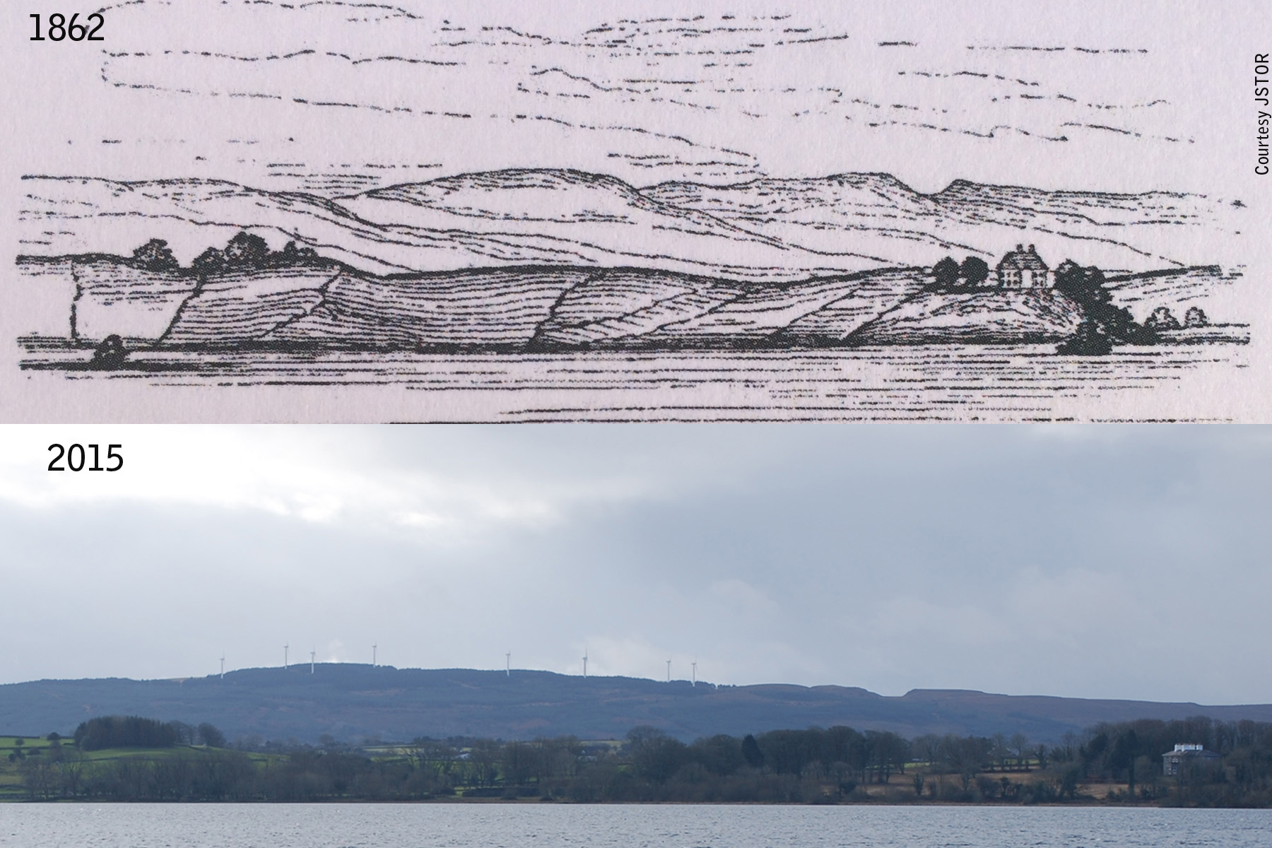
In 1862 G. Henry Kinahan carried out an archaeological survey of the Crannoges on Loughrea Lake.
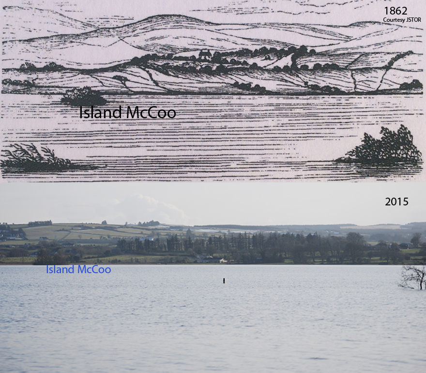
His study shows two interesting sketches of the southern and western shores of the Lake, which were sketched looking from the Fairgreen.
“Reed Island lies a little on the right of sketch, Fig. No.1. It was not included, as it lies so low as to be unobservable in any picture.
Shore Island lies immediately below Lord Dunlo’s house, in Fig. No.1. Ash Island is towards the left of the same sketch, near the shore.”
Today Lord Dunlo’s house has become the Bishop’s house and is almost completely surrounded by large trees. In summer time the house is almost completely blocked out by the trees, with only the chimneys of the house visible from this vantage point. This photo was taken in winter time.
Overall there are many more trees there today and particularly close to the shore-line. Beyond the first set of hills you can also see the extensive conifer plantations that cover the Slieve Aughty hills.
The distant wind turbines at Derrybrien are also a recent addition to the landscape. Do they take from it and will they be there in another 150 years ?

“Island McCoo is the wooded island, toward the left of sketch, Fig. No. 2”
On Crannoges in Loughrea. G. Henry Kinahan. Proceedings of Royal Irish Academy (1836-1869). Courtesy JSTOR


